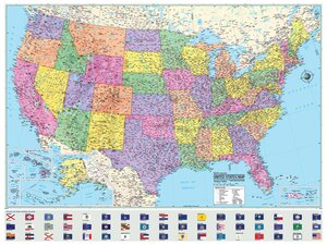
U.S. & World Political Rolled Map
https://theclassroomstore.com/products/united-states--world-rolled-maps-50-x-33
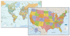
Durable map also offers national capitols, major cities, rivers, time zones and major peak elevations.
Options
Price
Qty
39.90
ea
Excellent eye catching large world map for home, office or educational. Heavy laminated write-on/wipe-off surface wipes clean with a damp cloth for repeat use and will last for years. Ideal for use in classrooms, shipping departments, offices, or wall decorations. Features national capitols, major cities, rivers. time zones. and major peak elevations. Includes water soluble marker and four peel and stick tabs for hanging. Individually tubed for easy shipping. Printed on 100% post-consumer recycled FSC certified paper with soy inks. Made in the USA. Measures 50" x 33".